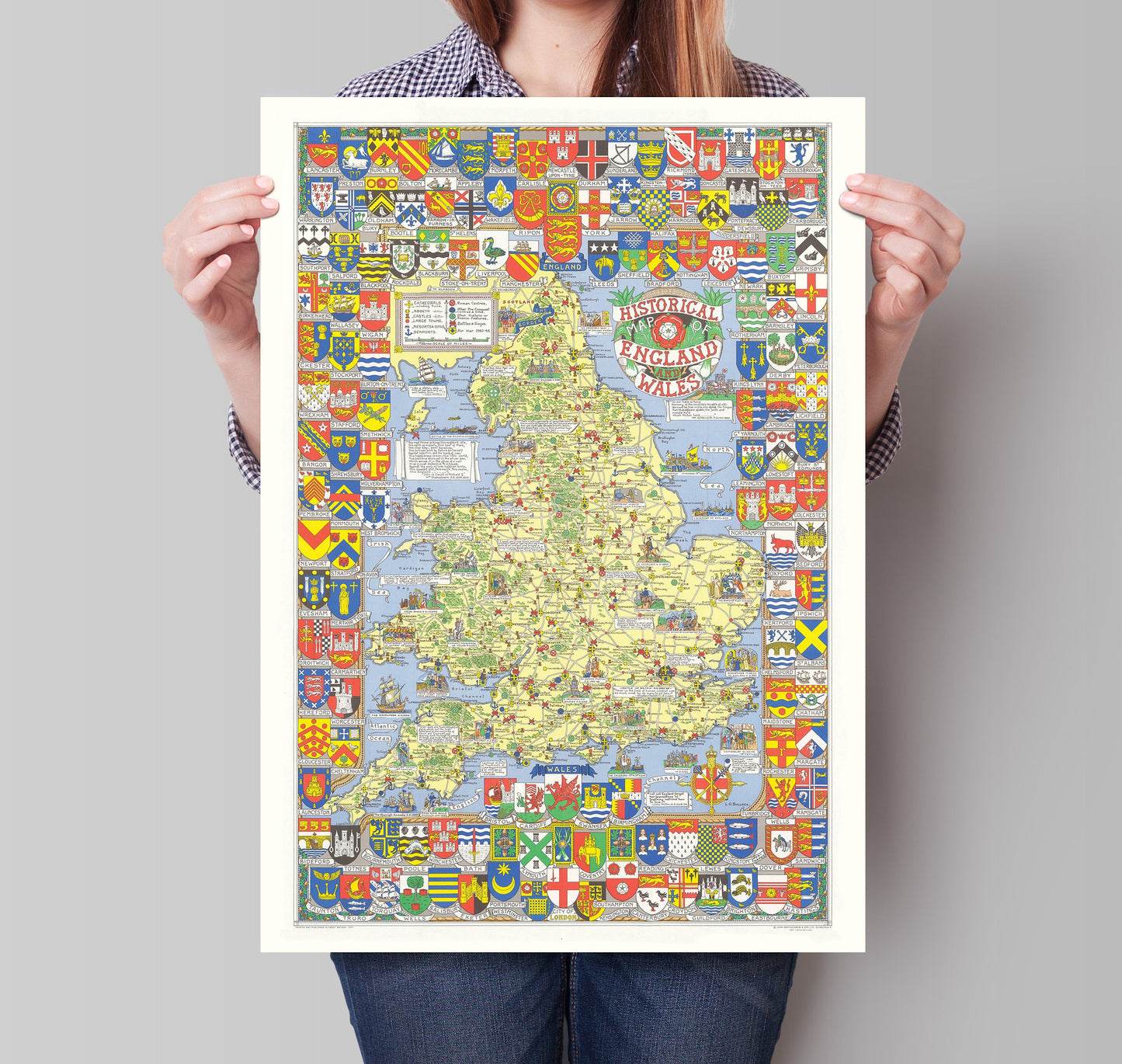
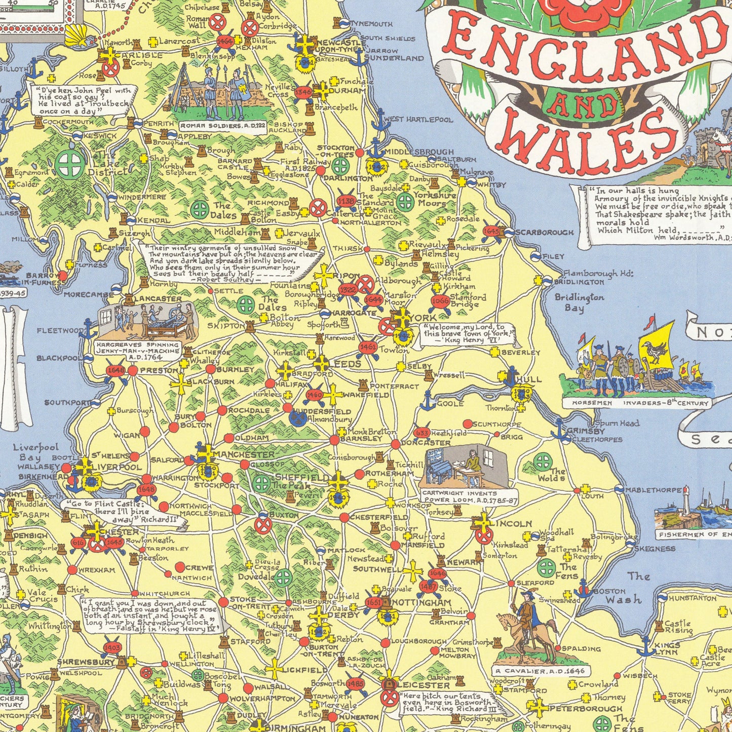
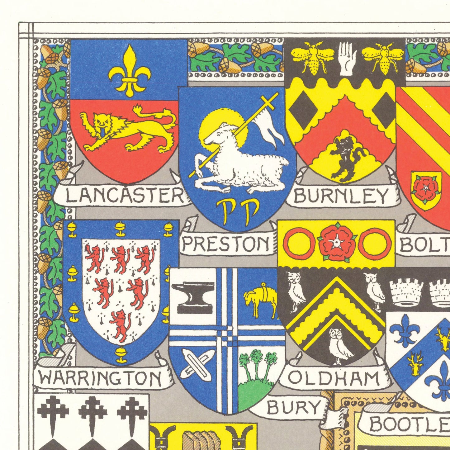
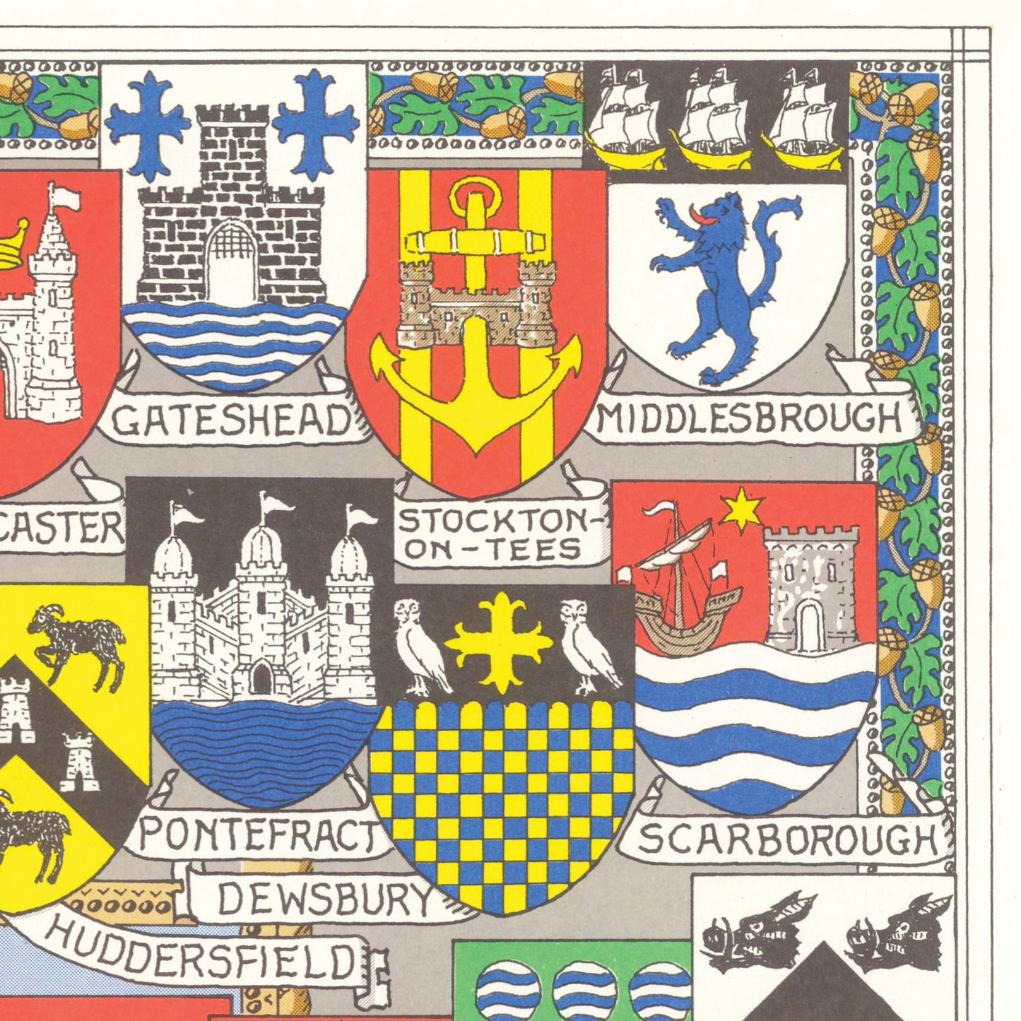
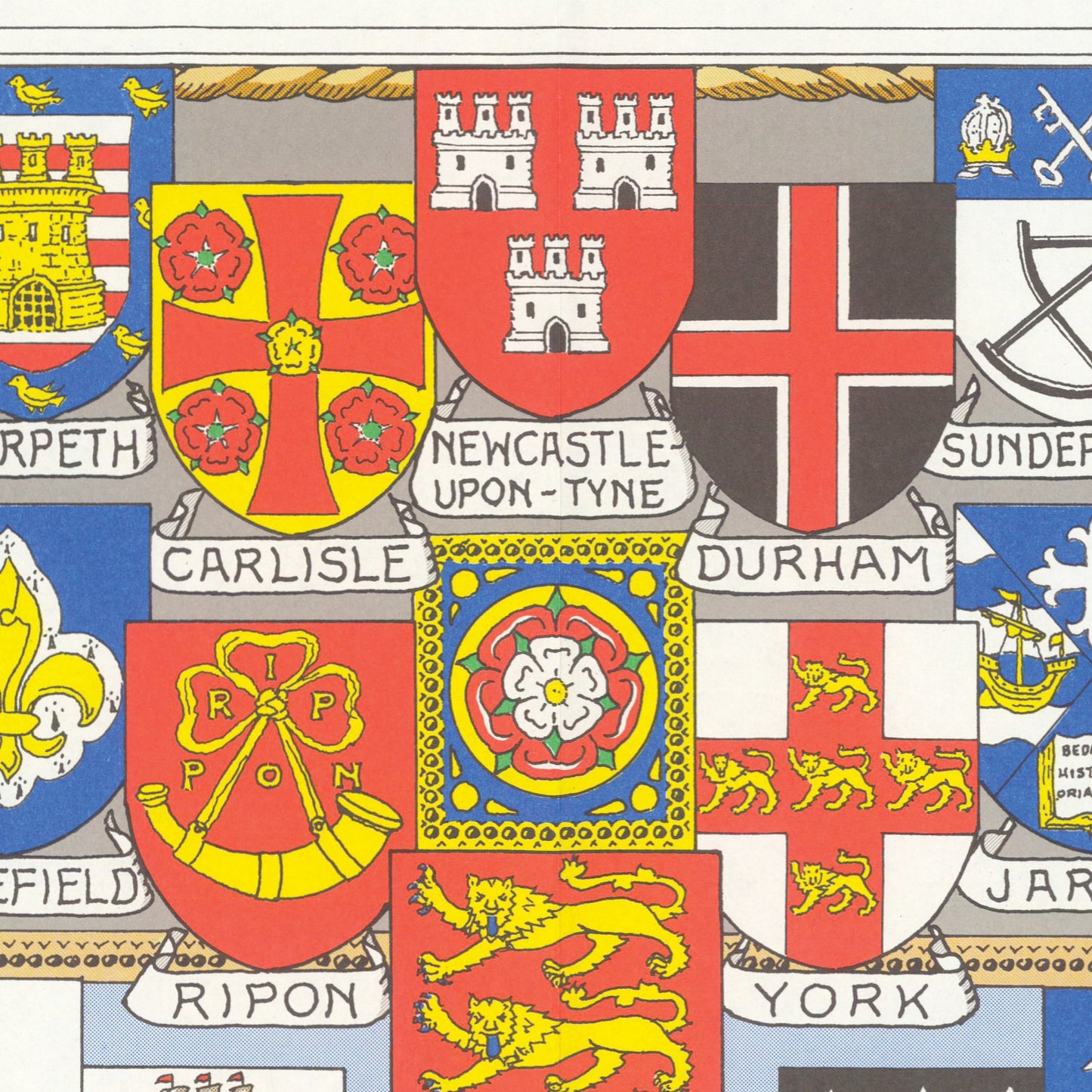
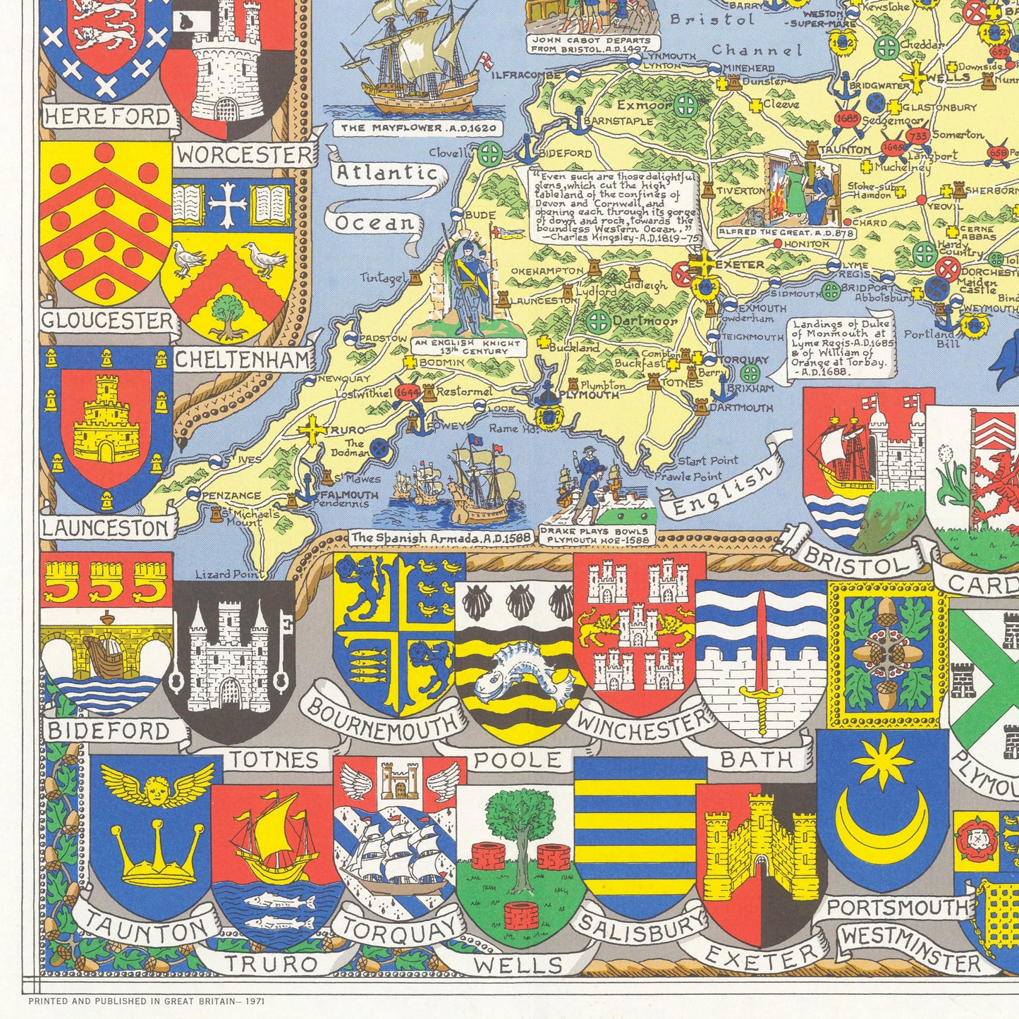
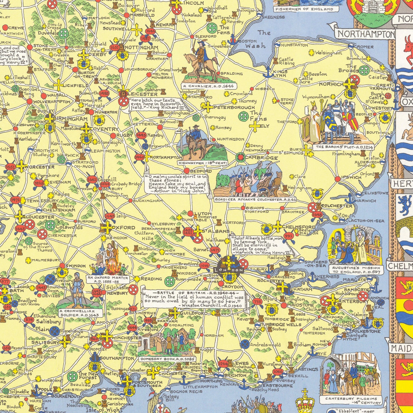
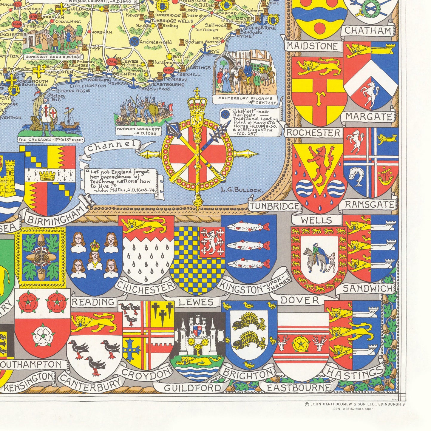
The new Pictorial map of England and Wales Originally printed in 1971 this Historical map of England and Wales shows cities, roads, castles, churches, topography, bodies of water, drainage, coastlines, islands and ports. Available as:A2: 23.4 x 16.5 inches A1: 33.1 x 23.4 inches
A0: 46.8 x 33.1 inchesAvailable on 180gsm matt poster paper
or 200gsm satin poster paper.*Frame not included*25% OFF YOUR ORDER WHEN YOU ORDER ANY THREE PRINTS OR MOREVINTAGE MAP REPRODUCTION: Add a touch of class to any room with this beautiful stylish decorative print. Everyone loves a good looking map!QUALITY INKS: Printed using long-lasting pigment inkARTWORK MADE TO ORDER IN THE UK: Reprint made only when you order it. Every map will have minor adjustments to optimise it for print. FRAME READY: This unframed poster is shipped in a poly sleeve inside a thick postal tube, ensuring it is delivered crease-free. Print made to fit standard frame sizes.