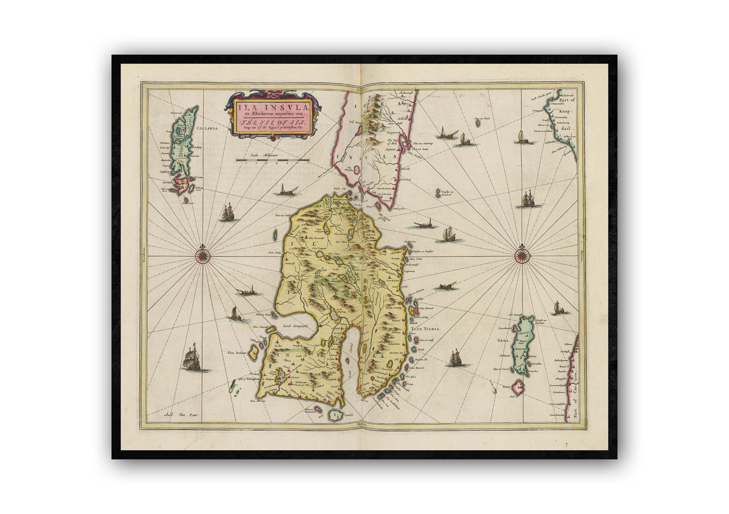
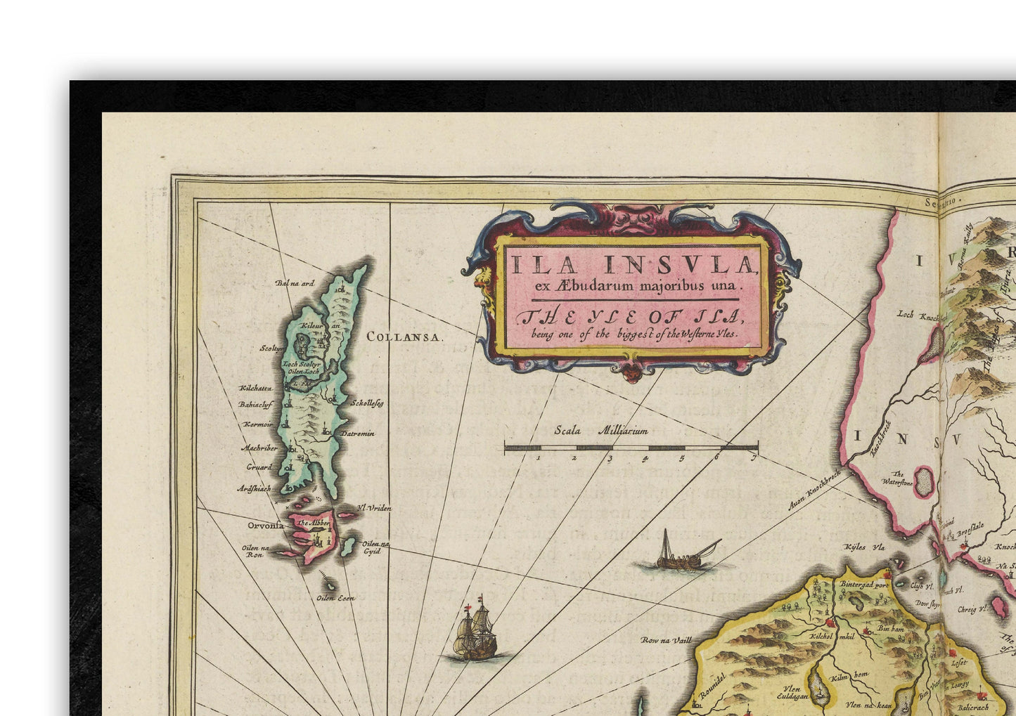
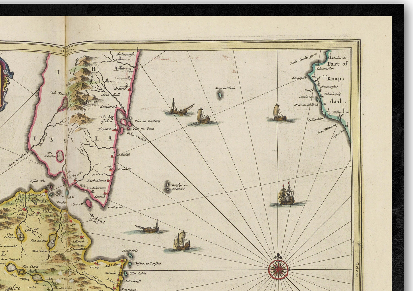
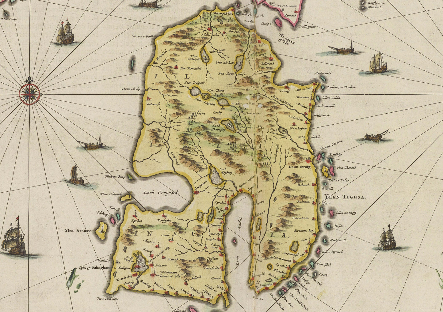
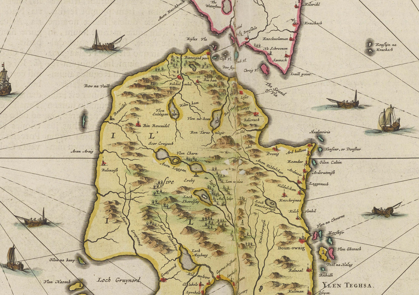
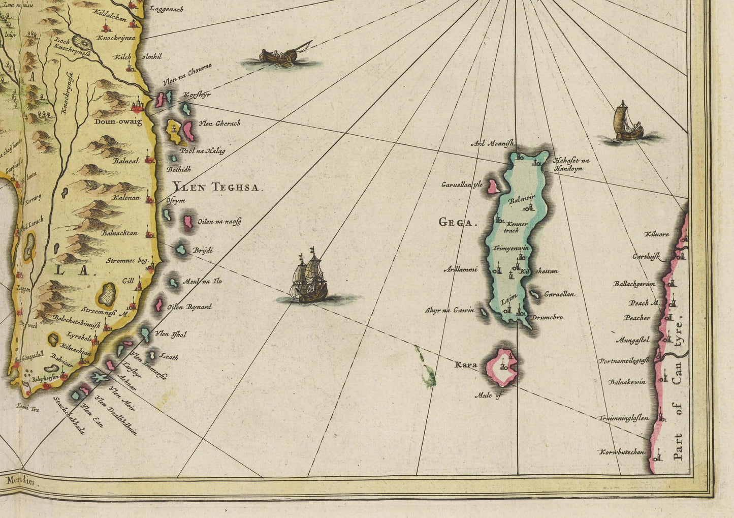
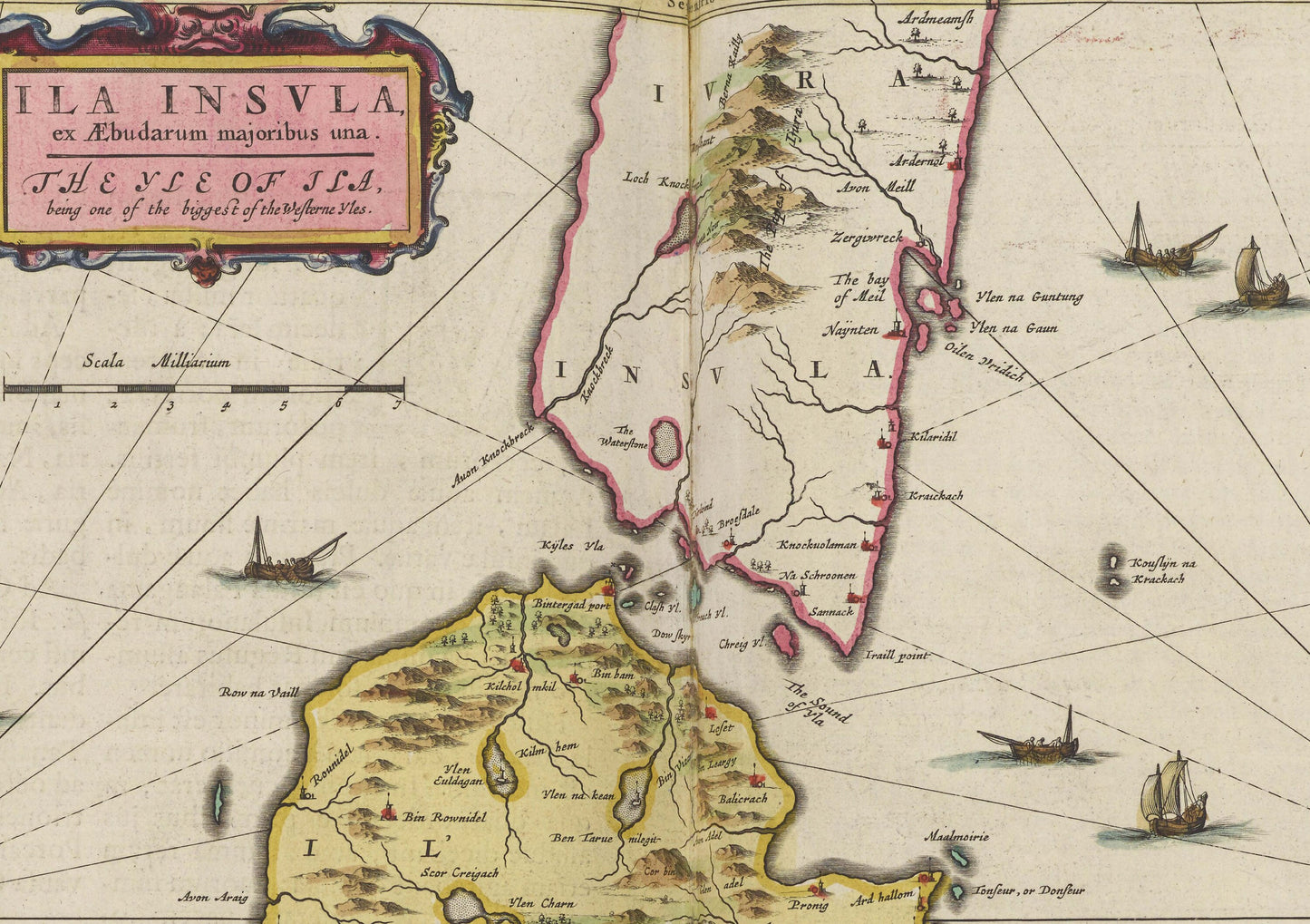
Islay Map
This is a reproduction of an 1665 Map of Islay Island by Joan Blaeu.
Originally titled ‘Ila Insvla’ This old map of Scotland centers on Isle of Islay. This ancient map is from the Atlas Maior published in 1665. The map covers modern-day Port Ellen, Isle of Jura, Islay, Isle Of Islay, Of Islay, Jura, Gigha, Western Isles, Jura Historic Print, Askaig, Ardmore, Crinan, Ardminish, Achahoish, Scalasaig, Craighouse, Feolin Ferry, Tayvallich, Achnamara, Carsaig, Bowmore, Bruichladdich, Port Charlotte, Portnahaven, Port Wemyss, Lagavulin, Laphroaig, Muasdale, Kilchoman, Clachan, Tayinloan, Port Askaig, Glenbar.
Available as:
24 x 18 inches
30 x 24 inches
Available on 170gsm matt poster paper
or 200gsm silk poster paper.
*Frame not included*