1
/
of
9
Printagonist
Palestine Map - Topographic Shaded Elevation Relief Map - Vintage Style - Bible Study - 12 tribes - Asher - Nephtali - Gad - Judah - 1844
Palestine Map - Topographic Shaded Elevation Relief Map - Vintage Style - Bible Study - 12 tribes - Asher - Nephtali - Gad - Judah - 1844
Regular price
£44.99
Regular price
Sale price
£44.99
Unit price
/
per
Tax included.
Shipping calculated at checkout.
Couldn't load pickup availability
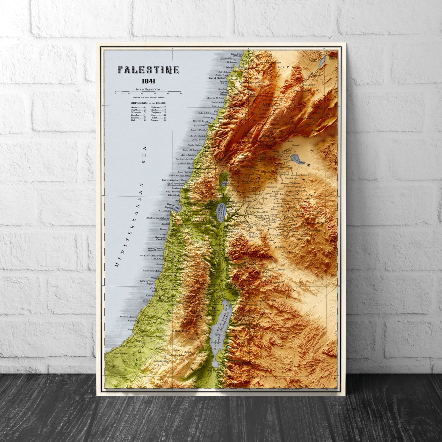
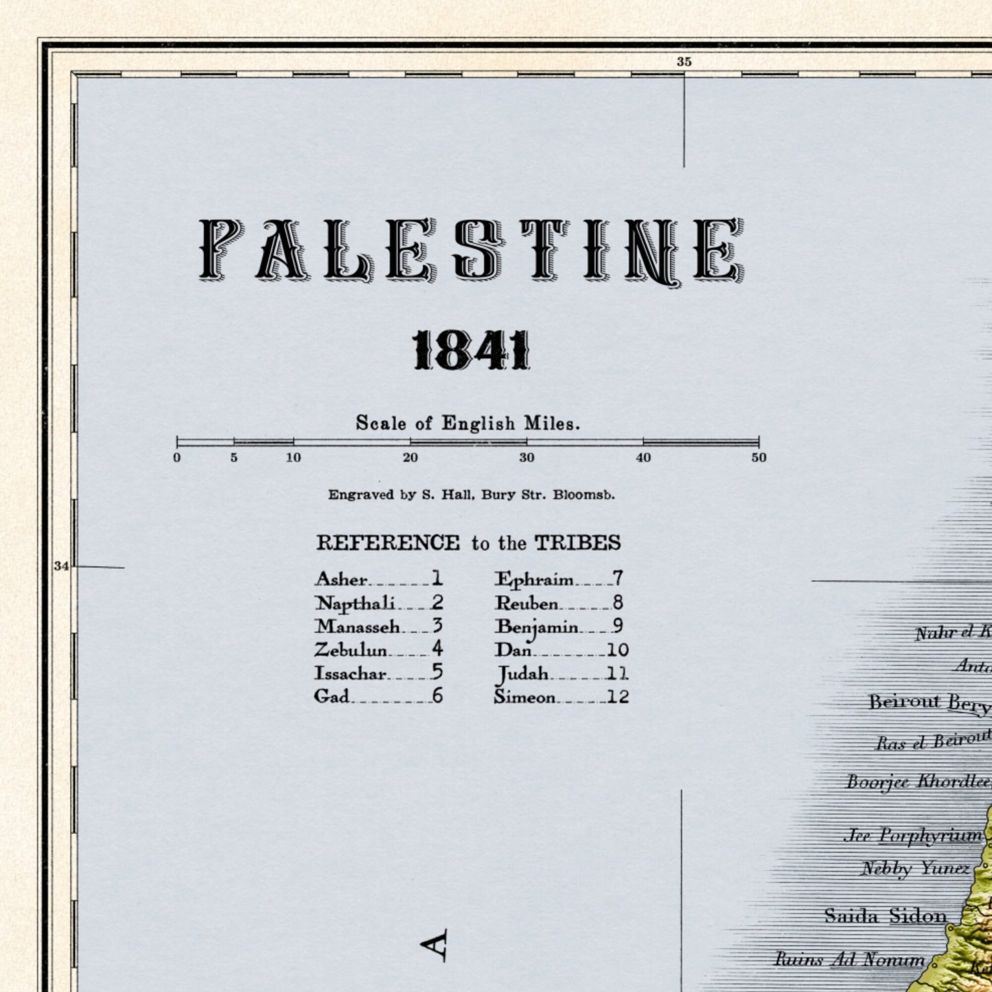
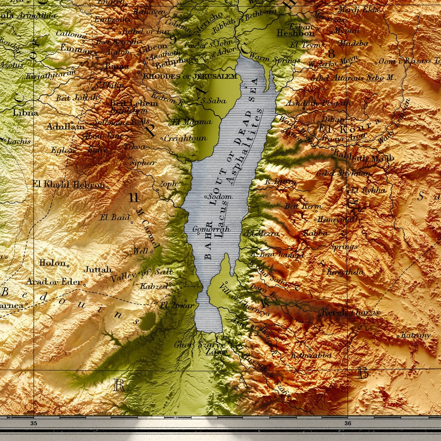
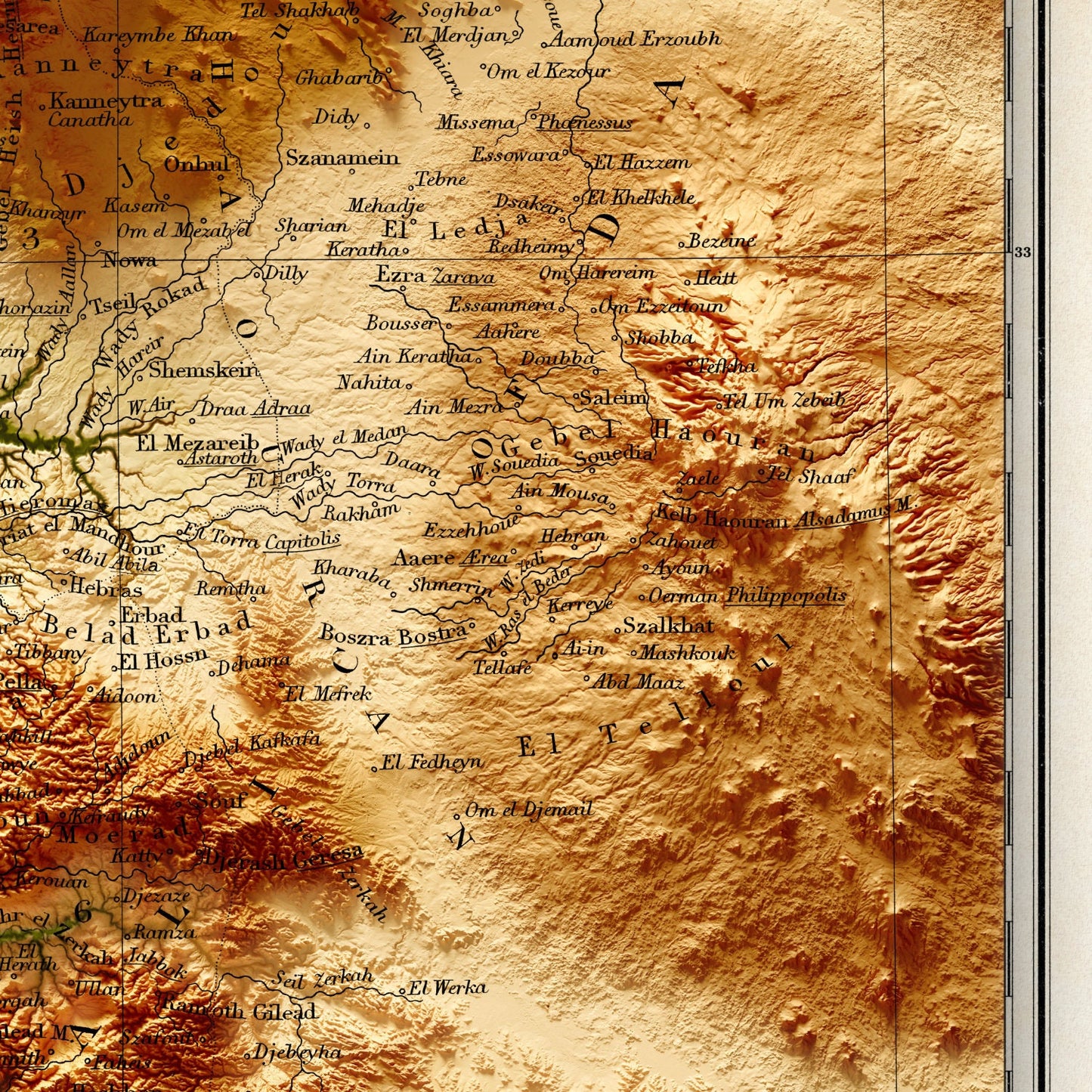
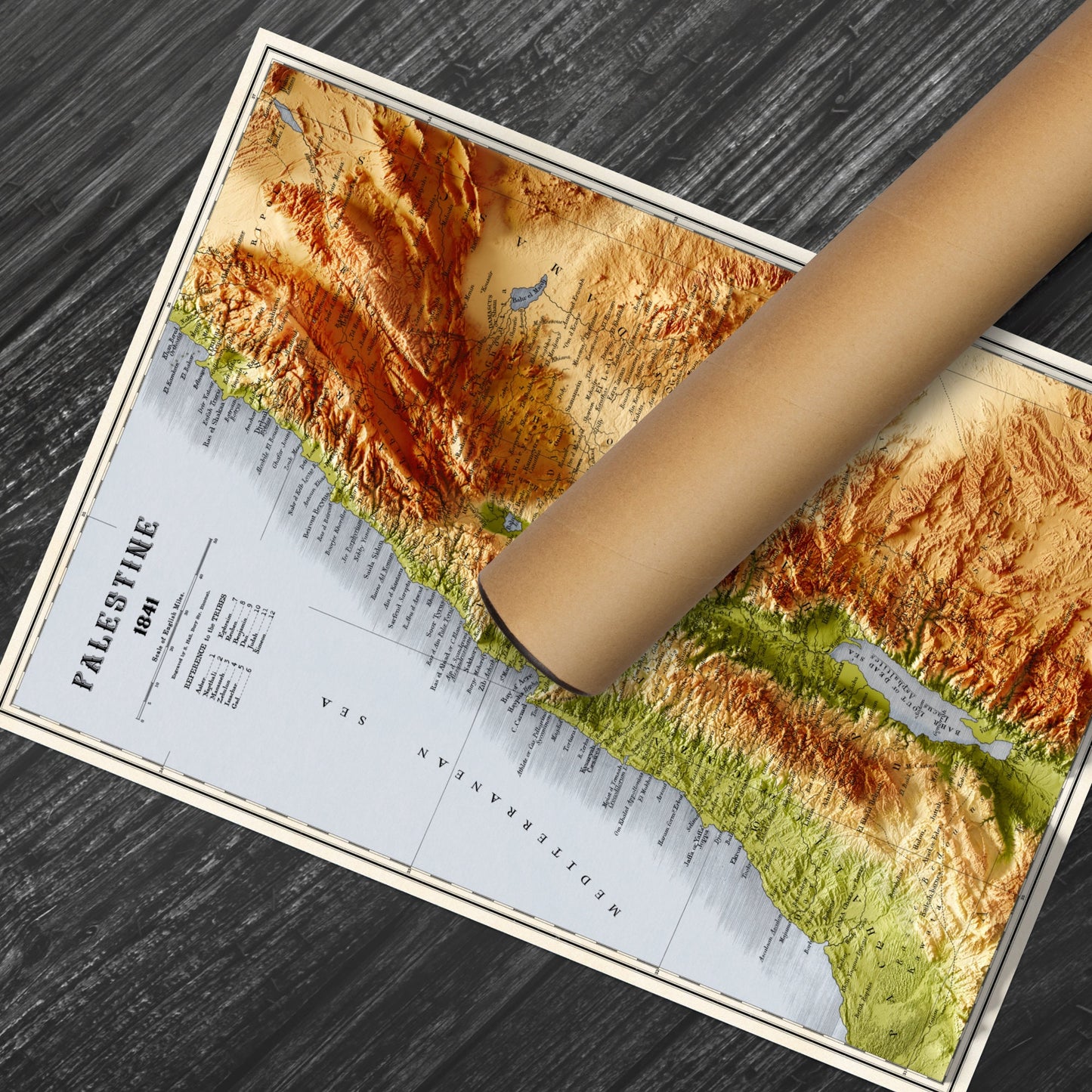
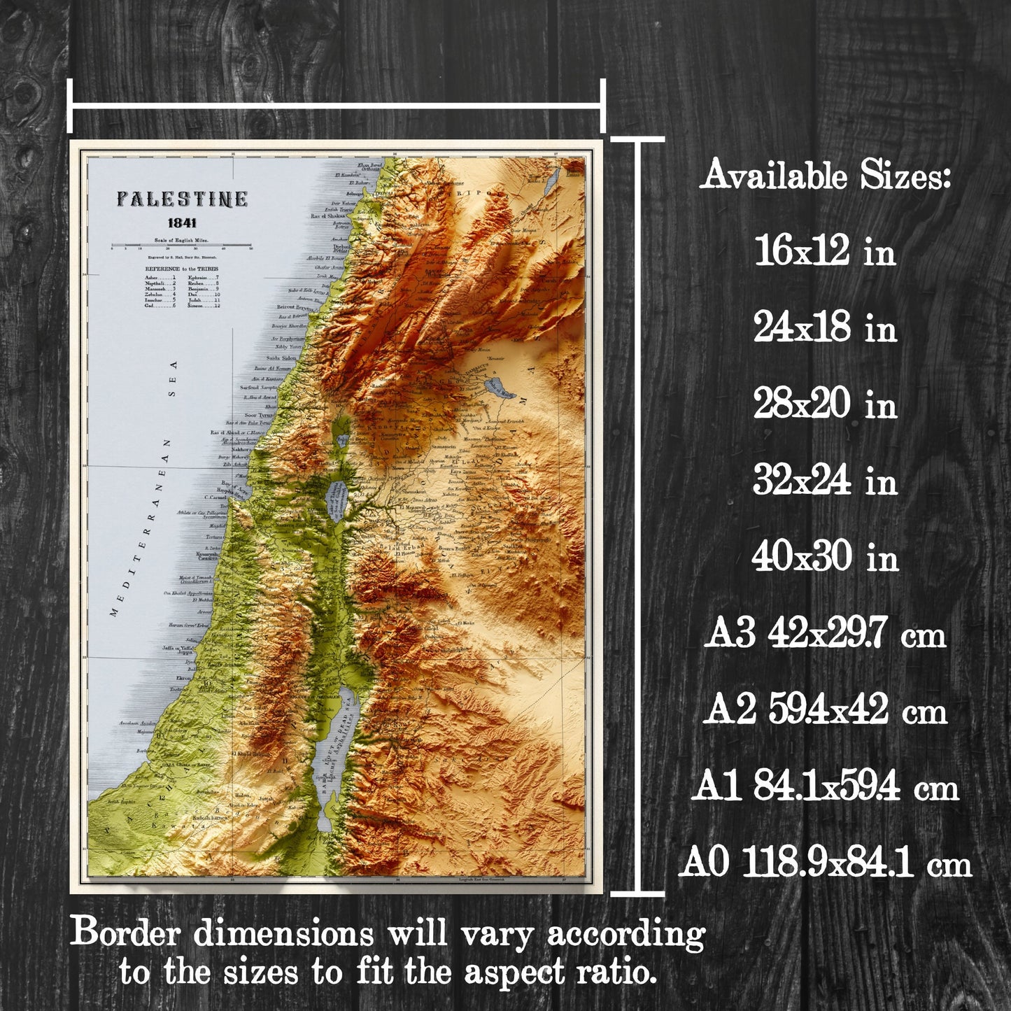
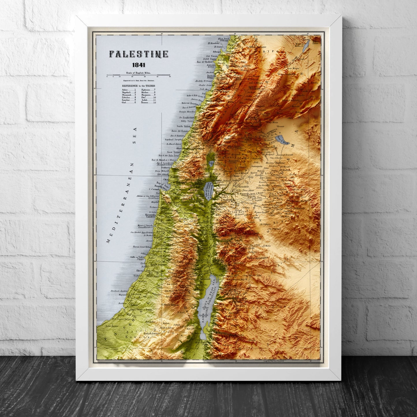
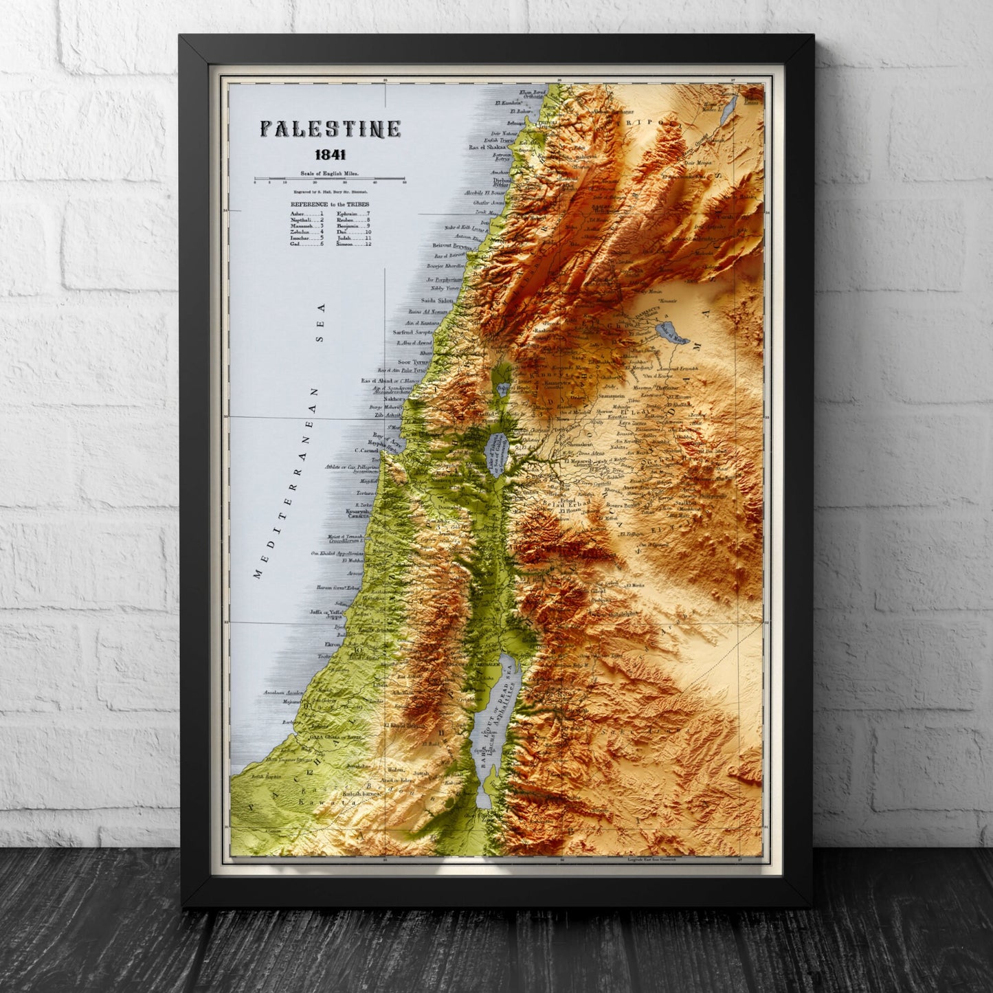
This stunning map of Palestine, published in 1844, depicts the Holy Land with intricate detail and beauty. It features the region divided into the 12 tribes of Israel with clear border lines indicating the specific locations of each tribe:1-Asher: One of the 12 tribes of Israel, known for their skill in producing olive oil and other agricultural products.
2-Naphtali: Known for their expertise in trade and commerce, and for producing high-quality textiles. 3-Manasseh: One of the two tribes descended from Joseph, known for their bravery and military prowess. 4-Zebulun: Known for their seafaring abilities and for their contributions to commerce and trade. 5-Issachar: Known for their skill in agriculture and their wisdom in matters of the law and governance. 6-Gad: Known for their bravery in battle and their loyalty to their fellow Israelites. 7-Ephraim: One of the two tribes descended from Joseph, known for their leadership and strength. 8-Reuben: Known for their strength and military prowess, but also for their tendency to act impulsively. 9-Benjamin: Known for their skill in battle and their loyalty to the other tribes. 10-Dan: Known for their skill in metalworking and for their success in battle. 11-Judah: One of the most important tribes, known for their leadership, strength, and loyalty to God. 12-Simeon: Known for their faithfulness to God and their willingness to defend their fellow Israelites.The map also showcases the topography of the land and includes names of cities and towns, as well as rivers and other notable landmarks. It offers a unique insight into the political and geographical landscape of Palestine mentioned in the old testament. This reproduction would make a great addition to any historical or religious collection, or simply as an intriguing piece of decor.PLEASE NOTE: This is not a 3D map. This is a decorative map printed on poster paper (2D).This is not a 3D model.Relief shown by hypsometric tints and spot heights; depths by bathymetric tints. Shows shipping routes, etc. Inset at (ca. 1:49,500) scale. Includes "Section across Judea and the Dead Sea." Available on 180gsm Matt paper or 200gsm Silk paper Poster contained within polythene tubing. Sent in doubled cardboard tube.SPECIAL OFFER: Buy any 3 maps and get 25% OFFMore relief maps are available:Great Britain: https://www.etsy.com/uk/Printagonist/listing/1119128062 Ireland: https://www.etsy.com/uk/Printagonist/listing/1222098775 Harris: https://www.etsy.com/uk/Printagonist/listing/1108751094 Iceland: https://www.etsy.com/uk/Printagonist/listing/1196544263VINTAGE MAP REPRODUCTION: Add a touch of class to any room with this beautiful stylish decorative print. Everyone loves a good looking map!QUALITY INKS: Printed using long-lasting pigment inkARTWORK MADE TO ORDER IN THE UK: Reprint made only when you order it. Every map will have minor adjustments to optimise it for printFRAME READY: This unframed poster is shipped in a poly sleeve inside a thick postal tube, ensuring it is delivered crease-free. Print made to fit standard frame sizesFor orders outside UK please expect delivery between 2 to 4 weeks For speedier option you may wish to consider courier.Please note FRAME NOT INCLUDED, for display purposes only.
2-Naphtali: Known for their expertise in trade and commerce, and for producing high-quality textiles. 3-Manasseh: One of the two tribes descended from Joseph, known for their bravery and military prowess. 4-Zebulun: Known for their seafaring abilities and for their contributions to commerce and trade. 5-Issachar: Known for their skill in agriculture and their wisdom in matters of the law and governance. 6-Gad: Known for their bravery in battle and their loyalty to their fellow Israelites. 7-Ephraim: One of the two tribes descended from Joseph, known for their leadership and strength. 8-Reuben: Known for their strength and military prowess, but also for their tendency to act impulsively. 9-Benjamin: Known for their skill in battle and their loyalty to the other tribes. 10-Dan: Known for their skill in metalworking and for their success in battle. 11-Judah: One of the most important tribes, known for their leadership, strength, and loyalty to God. 12-Simeon: Known for their faithfulness to God and their willingness to defend their fellow Israelites.The map also showcases the topography of the land and includes names of cities and towns, as well as rivers and other notable landmarks. It offers a unique insight into the political and geographical landscape of Palestine mentioned in the old testament. This reproduction would make a great addition to any historical or religious collection, or simply as an intriguing piece of decor.PLEASE NOTE: This is not a 3D map. This is a decorative map printed on poster paper (2D).This is not a 3D model.Relief shown by hypsometric tints and spot heights; depths by bathymetric tints. Shows shipping routes, etc. Inset at (ca. 1:49,500) scale. Includes "Section across Judea and the Dead Sea." Available on 180gsm Matt paper or 200gsm Silk paper Poster contained within polythene tubing. Sent in doubled cardboard tube.SPECIAL OFFER: Buy any 3 maps and get 25% OFFMore relief maps are available:Great Britain: https://www.etsy.com/uk/Printagonist/listing/1119128062 Ireland: https://www.etsy.com/uk/Printagonist/listing/1222098775 Harris: https://www.etsy.com/uk/Printagonist/listing/1108751094 Iceland: https://www.etsy.com/uk/Printagonist/listing/1196544263VINTAGE MAP REPRODUCTION: Add a touch of class to any room with this beautiful stylish decorative print. Everyone loves a good looking map!QUALITY INKS: Printed using long-lasting pigment inkARTWORK MADE TO ORDER IN THE UK: Reprint made only when you order it. Every map will have minor adjustments to optimise it for printFRAME READY: This unframed poster is shipped in a poly sleeve inside a thick postal tube, ensuring it is delivered crease-free. Print made to fit standard frame sizesFor orders outside UK please expect delivery between 2 to 4 weeks For speedier option you may wish to consider courier.Please note FRAME NOT INCLUDED, for display purposes only.
Share